Got up to another beautiful sunny day - 19 degrees. After skyping with Michèle and family, we walked back to the beach we had been last night. These are tidal flats and KOA owns an area where campers can dig their own clams. You can rent the rakes from them as well. Had we known this, we might just had tried to get ourselves some clams to steam ... oh well ... Did chat with a couple of ladies who were doing just that. They are allowed 40 clams each daily. The rest of their group had walked up to the water's edge (see photo) to find cockles. They are good in clam chowder. They also mentioned a clam - gooey duck (I don't know the spelling but it sounded like that). These are gigantic clams with very long necks and they require a different technique for harvesting. Would love to see those.
We get back to the RV and finally leave around 10 am. This is a very productive area for oysters and shellfish. We stop at a Seafood Market and pick up a couple of bowls of clam chowder for lunch.
Driving along the Willapa Bay, mud flats go out as far as the eyes can see. Lots of clamdiggers. It's Sunday, remember.
The Town of Raymond - photographed their Welcome sign. It was so neat. As you drove into town, these wrought-iron cut outs were everywhere. Deer and family in the tall grass, a family grouping playing ball. Birds here and there. These cut outs were just so fantastic. Very original and very creative. There was one of two oxens (life size) pulling logs and being led by a man who is holding a whip, all these as wrought-iron cut-outs. Just amazing.
We took a secondary road in Raymond which was taking us to a coastal road but we decided the extra mileage was not worth it so we turned back after a few miles and got back on the 101.
We see a lot of clear-cut along the road - Weyerhaeuser - but also a lot of reforestation, some of it a few years old. Nice to see. In one instance, signs advised us that the trees had been blown down by hurricane force winds and that timber salvage had begun immediately after the storm. I think it was 2009.
Chohalis River, Montesano, Satsop, Elma. Rest Area - had our clam chowder (with Vermont baked oyster crackers!!) - it was delicious.
Back on the road, McCleary. People out driving in their vintage cars. Little Creek Casino.
We see mountains ahead, covered with snow (photo) - it's the Olympic Mountains. They are something to behold. We hadn't seen that kind of mountain in a very long time....brought back memories of weeks past.
Entering Hood Canal Watershed (photo). We stopped for an apple break and lo and behold we saw a couple of eagles flying, one actually landed at the very top of a very tall pine but he was too far for Ross to get a good photo.
Olympic National Forest, Quilcene River, Quilcene, Discovery Bay, Gardiner, Blyn, Sequim Bay.
We decide to ask the GPS where we could fidn a Safeway as we needed a few extra food supplies and she nicely complied..in Sequim.
At 4h30, we had arrived at our KOA campground and got a nice spot with sun and shade. Got a couple of loads of laundry done while we sipped our beer and nibbled chips. Got Ross's hair cut. After dinner was eaten and dishes done, we both had our showers.
It will be early to bed tonight as we need to get up really early tomorrow morning. We are taking the 8h20 ferry from Port Angeles to Victoria.
This is our last day of the first part of this incredible road trip we have been on. Starting tomorrow, we will be visiting with friends in Victoria and then in Surrey, BC.
Next Saturday, we embark on a 1-week cruise to Alaska with the 5 couples that constitute our Anniversary Gang. If it is possible on the ship, I will try and let you know what we are up to. However, if not, then the blog will start again on or around June 23, when we head home.
Note: Unable to upload photos. Will try again some other time.
Sunday, June 5, 2011
Saturday, June 4, 2011
Day 48 - Bay Center, Washington


Our weather is certainly looking up. We had breakfast outside on the picnic table this morning and last night, we had no need for the furnace. I guess we had to head north to get the warm weather!!
I have included a photo taken at the aquarium yesterday since I realized, too late, that I had mentioned murres twice and it would be nice to see what they look like. These birds actually also live in the Arctic.
In Pacific City, we left Highway 101 and followed the coast. The second photo was taken of one of these enormous beaches that Oregon has all along the coast. Being Saturday, there were lots of people around...if you can see them on the photo.
It was a lovely drive until ... we had an extremely close encounter with a deer ... he just flew in front of us, we only saw the top of his head and part of his upper body .. and he was gone. That we did not hit him is unbelievable. He came from nowhere, so fast ... he was lucky and we were unbelievably lucky!! Ross was driving around 25 mph on a sharp curve at the time and that was what really saved us ...
We drove on to Cape Lookout where from a viewpoint, we parked and had our muffin break. We can't tear our eyes away from the coast, it is so beautiful.
Netarts Bay, Whiskey Rd. Clamdiggers. Cape Meares. We turned off to visit the lighthouse. This is the one we had been told had been vandalized and its lens has been shattered by a shotgun. It will not be repaired as the cost would be in the million dollar price. Useless vandalism.
Tillamook Bay. Ross spotted with the binoculars the Tillamook Rock Lighthouse which is 1.2 miles seaward. It was at one time used as a columbarium. It is now the only privately-owned Oregon lighthouse on the National Register. No public access.
At another viewpoint, we take our last photo of the Oregon Coast (photo). We have enjoyed it tremendously...
Back on 101, we drive by Garibaldi, Barview, Brighton. We visited a winery, the Nehalem Bay Winery. We bought a dessert (Blackberry) wine to bring to friends who have invited us for dinner in Victoria. Ross was not impressed by the other wines.
Arcadia Beach, really busy on this Saturday afternoon. Next town, Seaside. It is the oldest ocean resort in Oregon and has been visited since the 1850s. There is a Saturday crowd here as well.
Warrenton. We arrive in Astoria and head for the Astoria Bridge crossing the Columbia River. This bridge is 4 miles long, quite impressive.
We enter Washington and continue on 101 heading for Bay Center which is located across the bay from Long Beach. Ross had his wish for seafood or more exactly oysters for dinner as there was a restaurant located just one mile away from our campground. How lucky can you get. The last photo was taken from the docks located behind the Dock of the Bay Restaurant.
We finished off our day with a walk to the bay side to watch the sunset, a beautiful blue, pink and orange show of colours. Good night!
Friday, June 3, 2011
Day 47 - Lincoln City, OR


 We were leaving the campground by 8h44 this morning under a gloriously sunny sky. A perfect day for sand dunes.
Saunders Lake, Tugman State Park, Eel Lake, Clear Lake. Umpka Lighthouse View Point, Winchester Bay, Reedsport. Historic bridge over the Umpka River, Smith River, Gardiner.
Huge reforestation on the hill sides on both left and right of the road.
Tahkenitch Lake with very pretty cottages lining its shores.
We stopped at Dunes Overlook. We climbed up a very steep dune and behold the sea...met 3 fishermen all set up to catch sea perch. One of them really knew his business. A perfect day for fishing!
Siltcoos, Dunes City, Woahink Lake, Honeyman State Park, Glenada.
In Florence, we followed Rhododendron Rd. (there are many many gated communities...) to the North Jetty (you can see it in the 2nd photo way off in the distance). This jetty was built in 1986 with over 1,300,000 tons of stone which had to be mined and moved to this site. Designed by the US Corps of Engineers, the contractor actually finished it one year ahead of schedule. A major feat to be sure.
We enjoyed walking the beach where the rocks were covered by barnacles who emitted light sounds and if you looked carefully they were moving inside their openings.
Sutton Lake, Sea Lions Cave (we could see a few of them swimming from where we were standing ... we didn't actually pay to go and see the Cave).
Cape Creek, Heceta Head Lighthouse .. the sea is so blue. We enjoyed a very relaxed lunch sitting on the beach (photo). We watched as two crows and seagulls squabbled over bags of chips which had been left unattended on the beach.
Yachats, lots of homes dot the hills and down below. Waldport, very pretty town.
Alsea Bay, lily pads. Seal Rock.
Newport, Oregon Coast Aquarium. The six-acre, 40,000-squre-foot aquarium features more than 15,000 marine animals representing some 500 species. Indoor and outdoor exhibits feature coastal sea life, including sea otters, harbour seals, sea lions, jellyfish and giant Pacific octopus. They had a touch pool filled with sea stars, anemones, sea cucumbers (very squishy), and sea urchins (who hug your finger if you put it between their spines). What was unbelievable was a 200-foot acrylic tunnel running through three ocean habitats. Imagine having a leopard shark swim over your head...wolf eels, bat rays, and so many more fish. That was just amazing.
One of the outside attractions is an aviary where you walk in and see tufted puffins, common murres (yes the same ones we had photographed on top of large rock yesterday), pigeon guillemots, rhinoceros auklets and oyster catchers ... pretty neat. We also watched as they fed the sea lions, the seals and the otters. A great show ... We were very impressed by this aquarium. Oh yes and they had an anaconda (really big one that slithered in his aquarium), lizards, crocodiles and alligators (there was one who wanted out...). So so much to see.
Wish the grand kids had been with us.
We drove on and got to our campground around 5h30. A very nice one surrounded by trees, very green, and, we had dinner out on the picnic table ... it was 20+ degrees ... finally!!!
Ross is already asleep and now it is my turn. Another great day!
Thursday, June 2, 2011
Day 46 - North Bend, Oregon


Left the campground around 8h30, 13.8, cloudy .. and the fridge is on DC (driving current)!!
We are back driving with redwoods lining the road. Smith River - The rhododendron bushes surrounding homes are just so beautiful in many colours and then you see the odd wild one leaning through the trees.
We had to wait until the Liquor Store opened at 9h so we could pick up some beer we rather liked and wanted to bring home, just in case we can't buy it in Oregon...
9h19 - Welcome to Oregon - Visitor Center - Crissey Field State Park, under gray gray skies.
Walked the beach. The ocean, the beach, the sky, all are gray .. Picked up some literature and we're off.
Drove through Brookings, tried to find a harbour road but no good.
A little further on, Lone Ranch Beach, Scenic Corridor. It was perfect for a muffin break. Sprinkling rain. Whalehead Island. We can see sea birds nesting on the top. Ross took a photo so we could blow it up tonight and identify them. They are common murres. In the description, in my book, they say that on land it stands upright, penguin-fashion. That's why I thought they might be puffins...
Arch Rock (photo) - walked up to viewpoint. And again, there were birds nesting on top, seagulls this time and would you believe, one Canada goose among them!
Lots of creeks and lots of points around here but the scenery is ever changing and just beautiful.
Purple lupines abound everywhere.
Cape Sebastian Viewpoint - a great lunch spot! We could scan the sea and skies as we lunched.
The sun is getting stronger. Gold Beach - Rogue River - lots of bushes with yellow flowers.
Humbug Mountains. Stop for look out. This is approx. where, in 1993, in September, we had spotted a whale but not today...
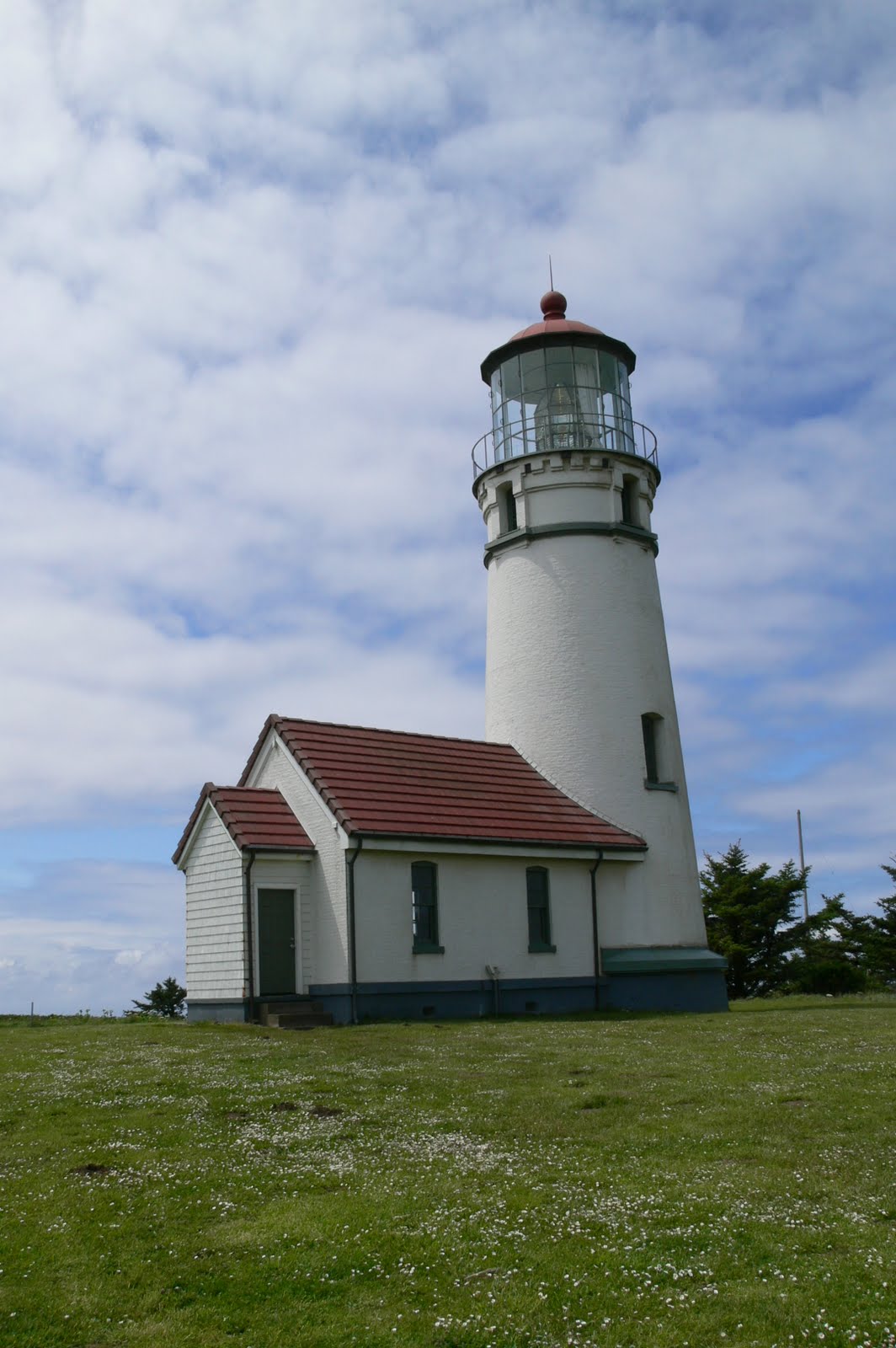
Port Orford. Cape Blanco State Park - Lighthouse (photo). Visitor Center where we are greeted and given the history of this lighthouse. Oldest standing lighthouse on Oregon Coast, commissioned in 1870 to aid shipping generated by gold mining and lumber industry. Its first keeper was a Mr. Langlois (pronounced Langless) .. can you believe it! I wonder how he happened to be in Oregon at that time? We were able to go up in the tower and were explained the duties of the keeper and his assistants as well as how it was lit with liquid refined lard in the first years of operation.
Back on the road, we drive by the town of Langlois further on. Coos County. We take Beach Loop Rd. Face Rock Wayside. The wind is wicked. Coquille River South Jetty. A very developed area with lots of cottages, hotels, motels, etc.
Back on 101, Coquille River (Coquille is the name of an Indian tribe). We arrive in Coos Bay and drive along sand dunes and finally arrive at our campground at North Bend after crossing quite an impressive bridge, the McCullough Bridge.
Our campground is very popular with ATV people who like to drive into the sand dunes. Certainly a busy place when we arrived. It is now dark and all is quiet.
This was a great first day in Oregon. The skies are clear tonight. Looking forward to a sunny day tomorrow and maybe it will warm up a little now that we are heading north!!
Wednesday, June 1, 2011
Day 45 - Crescent City, CA


 Well our morning didn't start all that good ... Claudette forgot the fridge again!!... this time the meat in the freezer was thawed so out it went. Luckily we only had a couple of things.... So off we went to the closest Safeway and bought replacements. I think I will have to make myself a gigantic reminder....The only good thing this morning is that we got to skype with Michèle and family... the best connection we have ever had with them ...
And the sky is pretty good. It isn't raining... Shortly after we got on the road, we were by the coast again. It was so nice to see the ocean. Little River State Beach.
Stopped at Rest Area which had a gorgeous Redwood forest adjacent. When you enter, it is like being in a church, so quiet and so majestic. From a poster, we learned that they had a major forest fire in 1945 which destroyed 50% of the Redwoods but it's incredible how they have returned.
We turned back on an old road and did a photo stop (see photo). If you look very closely you will see that the rock is covered with sea lions. We had fun watching them climb up the cliff of the rock. Just amazing. We could certainly hear them.
Back on 101, we entered the forest again with a wiggle road, purple lupines hanging from the cliffs and Spanish moss hanging from trees.
Stone Lagoon, Freshwater Lagoon. Entering Redwood State Beaches & Parks. We are back on the coast. We parked and had lunch then went for a walk (see photo). The surf was perfect but no surfers around. When we mentioned that to two bikers who were walking by, one observed that there might be some white sharks around. Yea, that would make sense, with all the sea lions we saw earlier.
Orick, lots of wood carvings. We drove by Lady Bird Johnson Grove .. the one we visited in 1993. At a turn off, we were able to see some Roosevelt elks in the field from afar. You are warned not to approach them on foot. We were told afterwards that they are fierce animals.
We drove through the Elk Prairie Parkway with again unbelievable Redwoods (see photo). A prehistoric forest of giants. I believe they only exist on the coast of California and Oregon.
Another turnoff. We drive up to the ReQua Overlook. Spectacular (photo). This is where the Klamath River comes into the sea. There were sea lions down below. A photographer with very powerful binoculars told us there were ospreys in the trees as well. With my binoculars, I could barely see them. He had quite a collection of photos (for sale) he had taken of whales, eagles, bear, mountain lion, sea lions. A very busy cove. He had a photo taken recently of a female whale with a young one.
Back on 101, we got some rain. Not bad as it is almost 3 pm. Actually it poured and by the time we got to Crescent City, it prevented us from visiting the Battery Point Lighthouse Museum. Too bad.
By the time we drove into the campground, it had stopped and we spent a very nice evening. Went for a walk through a forest of Redwoods which is on the property. Amazingly huge stumps. One of the trees' roots are completely out of the ground and from these roots another tree grew. Incredible. Well time to call it a night.
Tuesday, May 31, 2011
Day 44 - Eureka, CA


 We have sun & clouds this morning.
We decided this campsite in Westport must have been our worse KOA so far. They had lousy bathrooms and when I took my shower, my dry clothes were dodging the drips of rain from the skylights overhead. Not great. I guess we are getting spoiled by some pretty nice ones we have had so far... and yet this was our most expensive one ... go figure!!
After a short drive up the coast (see photo of seagull), we entered the forest, leaving the ocean behind for a couple of days we figure.
This road is one of these famous zigzag ones and after more than 50 minutes (28 miles), we were glad to be on a straighter course. We remembered this one from 1993... This road is situated between two mountains so you are literally climbing through a crevice. The road itself is excellent, very smooth. We have to remember that we have a Corvette driver behind the wheel!!
We enter the Redwood Forests. In Leggett (pop. 315), we take a small detour to visit the famous Chandelier Tree (see photo) at 315 feet tall, it measures 21 feet in diameter. It was cut out in the 1930s (see photo of me, usually a car would be able to drive thru but not with the Roadtrek). This is the famous one! It has been featured in National Geographic and many other publications. It is still privately owned by the same family in its 4th generation. Ross remembers going thru it with his mom & dad back in 1964. We will be looking for the slide when we get home to compare and see how much it has grown in the last 50 years.
It is starting to rain. We are back on 101 now. Town of Piercy. Quite misty ahead. Rhododendrons by the roadside. The rain has stopped, sun shining. Garberville. Hills are yellow with green trees.
We take the Avenue of The Giants, a 31-mile road paralleling 101, from Phillipsville to Pepperwood. What an awesome drive. So tall and straight. They are so close to the road. Humboldt State Park. The rain again...the trees love the rain!! Now the sun is almost shining. We wonder how many trees were cut down to make this road possible.... This is when you would like a convertible or a sunroof to be able to enjoy the site of these trees. In some places, you actually drive around them. The forest floor is covered with moss and ferns.
We parked along the road, under the redwoods, for our lunch. That was very nice.
Raining again!! Eureka (pop. 26,000). Found our KOA campsite, we park and take naps. Nothing we can do, it's raining. As before, the rain stopped, but started again. We did a little carpet cleaning, and then the rain. It didn't prevent the beer & chips. Now we have had our dinner, it's almost 9 pm. I have some emailing to do. We hope that tomorrow will bring brighter skies. Tomorrow will be our last day in California.
Monday, May 30, 2011
Day 43 - Westport, CA


Memorial Day Monday. skies are gray, 12 degrees. We are back on California 1.
We can see from our first vista point that the ocean is much calmer today and rather gray, like the sky.
This coast road is something else as we turn and twist, the ocean below us, the road edged by forest one minute, winding into a valley next, we circle the beach below and up again with fields on the left and right. Up and down we go, left switchback then right switchback...Vehicles over 30-feet not recommended...
Elk (pop. 210). We turn around so Ross can get a photo of a great view (see photo) while I walk about in the Catholic Cemetery - Irish surnames, Italian surnames.
The sun is coming out. 14 degrees. Navarro Bluff Rd. Albion (pop. 398). Two cyclists on a bicycle built for 2!! A hiker!! Little River, Van Damm State Park, Mendocino (pop. 1008). We decide to visit Mendocino. It has many well-preserved 19th-century buildings and houses. The architecture reflects the New England roots of early settlers who were drawn by the rich timber resources of the surrounding countryside. It is on the National Register of Historic Places. We parked and walked a small trail to the ocean then back to Main Street where we purchased some beer and wine and stopped at a local coffeehouse for café au lait and very nice cookies.
Russian Gulch State Park.
We make another stop at Point Cabrillo Light Station built in 1909, for a 1-mile roundtrip walk to the Light Station. It was well restored and very interesting (see photo).
Caspar. Fort Bragg - did some food shopping, had lunch and headed back to the Mendocino Coast Botanical Gardens. We were spoiled by the rhododendrons (photo). Walked through several different gardens, one with cacti (photo) and another with heather which was beautiful.
Drove on to our campground in Westport which is located near a beach. Walking back to our RV we noticed that our neighbours were from Quebec so we went and knocked on their door to exchange travel stories. By the time we got inside to start preparing supper it was raining. Too bad ... but let's hope the sun comes back tomorrow. Good night!
Day 42 - Manchester, CA


Since this is Sunday, we treated ourselves to ham, eggs, fried tomatoes and toast for breakfast. Got dishes done, teeth brushed and we're on our way by 10 am. We actually managed to Skype with Andréa and phoned Miche briefly which was a surprise to us as we didn't realize we had internet. After all that, our computer wouldn't shut down. Ross finally solved the problem by removing the battery..et voilà!!
Back driving along the coast. Many State Beaches and all of them have turn outs, parking areas and paths down to the beach. We take advantage of many of them. Beautiful vistas. A heron flying by with his long legs stretched straight back. Some beautiful cottages, mostly cubic with angles, bleached wood exterior, lots of glass and balconies.
Sonoma Coast. Duncan's Landing, Shell Beach. We crossed the Russian River, Jenner (pop. 107)
Another one of those incredible zigzag rides.
Fort Ross State Historic Park – Lunch and visit. This fort was built in 1812 by the Russian American Co. to supply their posts in Alaska (Sitka) with mammal furs (otter), food produce, meat and lumber.
By 1841, they had exhausted the furs, so they decided to move on. The fort was sold and eventually in 1906 became one of the first parks in the California State Park System.The buildings are very interesting containing lots of artifacts from the Russian period. They were built of squared off lumber. I met a Russian tourist who now lives in California and he observed that buildings are still built in this manner in Russia today, the kit type that you can assemble. There was a chapel, very quaint. It has been rebuilt a couple of times because of earthquakes.
2 pm - we are back on the road. Salt Point State Park. Stewart Point, Sea Ranch. We are beginning to see a lot of homes. Roads after roads heading to homes on both sides. This is a very popular area. Again they are all built of gray bleached wood on the exterior.
Gualala Point, Mendocino County (pop. 585). A very touristy town. People milling about.
Anchor Bay, Point Arena (more of a Western town look). The wind is getting very strong.
3 pm – Manchester KOA. They have a spot for us but no water and no electricity but that's OK.
A busy busy campground. After having our beer, chips & dip, we dress up warmly (it is only 13.9), we follow a path thru a field bordered by wild flowers, lupines, iris and many others. I made myself a bouquet on the way back. There is a lot of mist. The beach has a few people huddled down. The sea is very turbulent, boiling away. The sun has come out a little more as we walk back.
After dinner, we walk thru the campground. It is buzzing with Memorial Day activities. Large groups have gathered for dinner. Children all around. Tomorrow everyone heads home! Time for us to hunker down for the night.
Day 41 - Bodega Bay, CA


Saturday morning. Still quite cool for California – 12 degrees C. We were off by 7h45 am.
We drive thru Santa Cruz. We follow the ocean with farm fields hugging the road. We passed at least 50 cyclists. This is a very popular activity in these parts. Cabrillo Highway. San Mateo. A lighthouse out on the ocean. Pescadero (Est. 1850). Now misty and hilly, lots of State beaches, and again, lots of cyclists. We have to agree this is a beautiful road to cycle on if you don't mind the cars and the Rvs but they do have a good shoulder.
We drive thru Santa Cruz. We follow the ocean with farm fields hugging the road. We passed at least 50 cyclists. This is a very popular activity in these parts. Cabrillo Highway. San Mateo. A lighthouse out on the ocean. Pescadero (Est. 1850). Now misty and hilly, lots of State beaches, and again, lots of cyclists. We have to agree this is a beautiful road to cycle on if you don't mind the cars and the Rvs but they do have a good shoulder.
We stopped at a road stand and bought strawberries (home grown and delicious), green pepper and a melon (Mexico, but delicious as well).
Half-Moon Bay, Canada Cove (a 55+ community). Venice Beach, French Creek and then “Ruisseau Français” which was pretty neat. Montera State Beach, back to road hugging cliffs. Pacifica – quite the ride. Road construction - they are actually tunnelling thru the mountain as the road is eroding away.
We have arrived in San Francisco, following 19th Ave. Slow traffic, lots of lights.
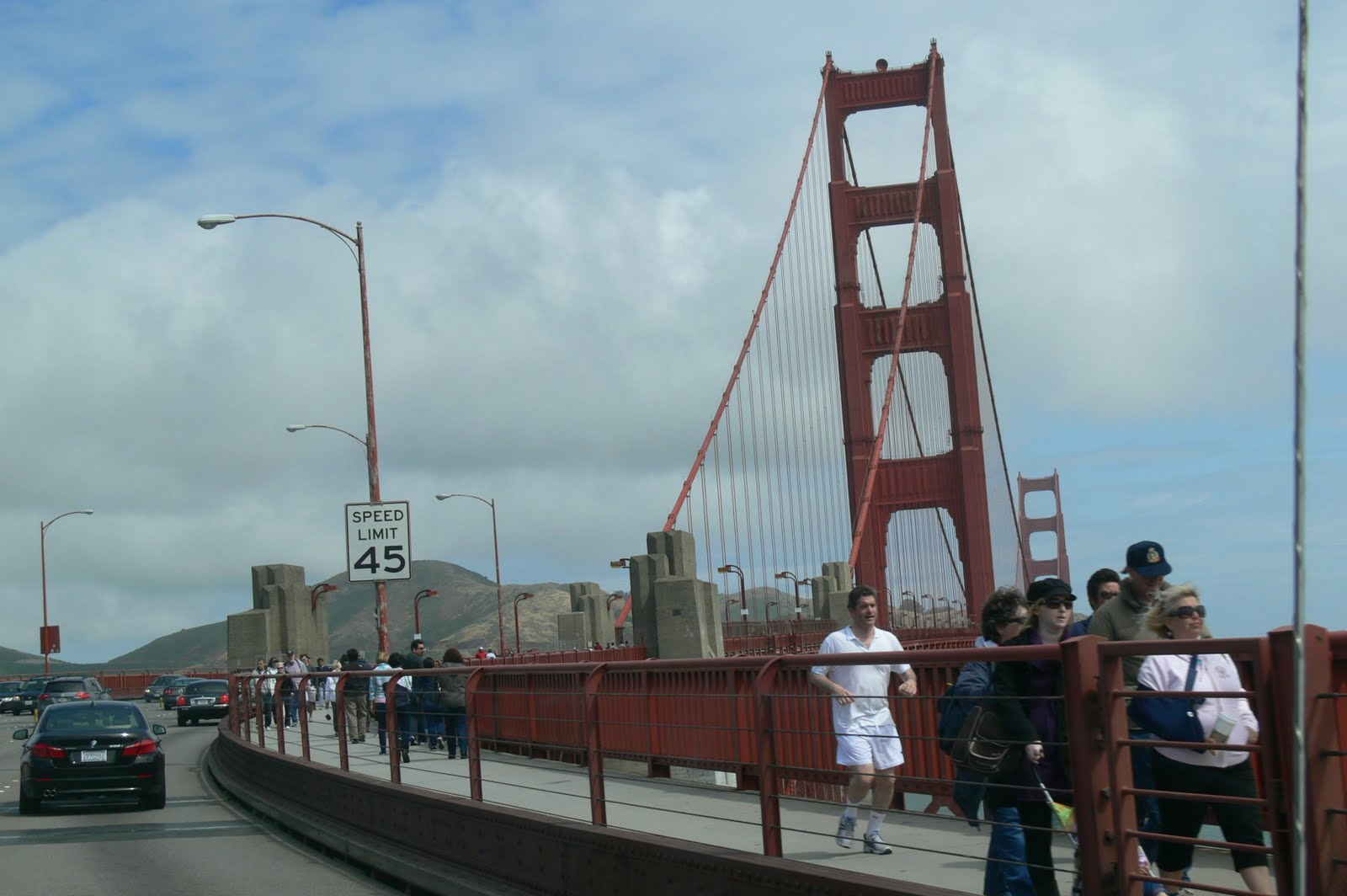
10h47 – We have crossed the Golden Gate Bridge. Lots of walkers taking advantage of the long weekend. We didn't stop. We had a great 3-day visit back in 1993.
We are now on Panoramic Hwy – 10 miles of zigzags. Ross is loving it!! but you still hope the oncoming car, truck is on his own side as you cannot see him ... At the end of it, Ross remarked that this was one of the windiest roads he ever encountered...
Stop at Muir Beach Overlook. This site is along the San Andreas Fault. We have lunch at Stinson Beach. Driving along a marsh with egrets and ducks. Point Reyes. Here comes another zigzag road! We are hugging trees again. Tomales (est. 1874). Tomales Oyster Bay Co. Oysters!! Beautiful smooth road.
It's raining..our first rain in California.
At 2 pm, we decide to turn in at Bodega Bay RV Park. They have a spot for us but no water and no electricity. That's OK. They also have a Seafood Restaurant, Brisas del Mar, where we decide to have dinner. Both were great decisions. The rain didn't stop until around 6 pm and we feasted on shrimp cilantro tostada, barbecued oysters, calamari and tiger prawns with 2 glasses of delicious Silver Creek Chardonnay (from the Sonoma County, where we are). The end of a great day, once again.
Half-Moon Bay, Canada Cove (a 55+ community). Venice Beach, French Creek and then “Ruisseau Français” which was pretty neat. Montera State Beach, back to road hugging cliffs. Pacifica – quite the ride. Road construction - they are actually tunnelling thru the mountain as the road is eroding away.
We have arrived in San Francisco, following 19th Ave. Slow traffic, lots of lights.
10h47 – We have crossed the Golden Gate Bridge. Lots of walkers taking advantage of the long weekend. We didn't stop. We had a great 3-day visit back in 1993.
We are now on Panoramic Hwy – 10 miles of zigzags. Ross is loving it!! but you still hope the oncoming car, truck is on his own side as you cannot see him ... At the end of it, Ross remarked that this was one of the windiest roads he ever encountered...
Stop at Muir Beach Overlook. This site is along the San Andreas Fault. We have lunch at Stinson Beach. Driving along a marsh with egrets and ducks. Point Reyes. Here comes another zigzag road! We are hugging trees again. Tomales (est. 1874). Tomales Oyster Bay Co. Oysters!! Beautiful smooth road.
It's raining..our first rain in California.
At 2 pm, we decide to turn in at Bodega Bay RV Park. They have a spot for us but no water and no electricity. That's OK. They also have a Seafood Restaurant, Brisas del Mar, where we decide to have dinner. Both were great decisions. The rain didn't stop until around 6 pm and we feasted on shrimp cilantro tostada, barbecued oysters, calamari and tiger prawns with 2 glasses of delicious Silver Creek Chardonnay (from the Sonoma County, where we are). The end of a great day, once again.
Friday, May 27, 2011
Day 40 - Marina, CA


 When we woke up this morning, we had no power so Ross went in the back to check the battery. It had hardly any voltage left. Ross started the engine as we realized that we (i.e. Claudette) had forgotten to switch the fridge to gas last night. Consequently, the refrigerator had drained all the power from the battery. Luckily, we were able to recharge it as soon as we got back on the road.
Those things happen...but they shouldn't.....
We had some friendly stellar jays come and visit us before we left our campsite.
Really windy back on Highway 1 as we drive north. Large waves down below with beautiful vistas at every turn. Gorgeous red leaf ground cover with pink, white, yellow blossoms. Our road takes us very close to the mountain with the cliffs below, winding back and forth.
We leave the coast to enter Carmel-by-the-Sea, A very quaint town with very pretty shops. We found a beach at the end of the road. Very beautiful (photo). Quite a few people milling about. We drive on and find Pebble Beach where we pay an entrance fee of $9.50 to take a 17-mile drive following the coast (photo) and driving by many million dollar homes, some of them castles all beautifully landscaped. We drive by the famous Pebble Beach Golf Course, and stop at different viewpoints, one was called Bird Rock (photo).
Leaving Pebble Beach, we enter the town of Monterey (photo) and again drive along the coastal route which is quite beautiful.
As we get back onto Highway 1, we arrive in Marina and Ross took an exit where there was mention of an RV Park. This is a great one as we have access to this incredible beach beyond the sand dunes. We spent a couple of hours just walking and watching the waves breaking on the shore. We returned tonight for sunset photos but it got really cold as the sun dipped into the horizon so we got back to our campsite for hot showers.
It is way passed by bedtime ... 11h27...but my blog is up to date!! Good night.
Day 39 - Pfeiffer State Park, Big Sur


7h20 am - This campground feels like an orchard. Very quiet. Cambria, Santa Rosa Creek, beautiful sunny morning. Spanish moss in the trees along the road. We drive through amazing vistas of soft velvet undulating hills. Like a hand pushed down on soft clay and molded indents between the hills. You would want to paint these they are so beautiful. An enchanting area (photo).
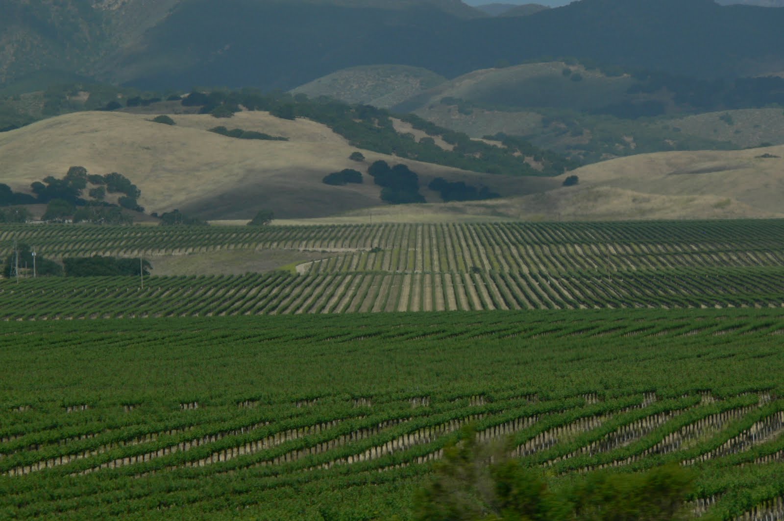
We start seeing vineyards on our left and on our right and pretty soon there are fields, immense fields covered with vineyards (photo), as far as your eyes can see. We were told that this area is now competing with the Napa Valley and you can easily see why.
As we drive on, the road changes drastically. Now we have parched hills and green trees below. And again, we start seeing more vineyards and orchards. Lockwood, San Lucas.
Now we are in an agricultural area, fields cultivated for broccoli, pimentos, again workers in the fields, iceberg lettuce, Taylor Farms. Greenfield. Very busy agricultural area. Spreckels, Salinas.
Now heading for California 1 and the coast. The ocean is beautiful, the colour turquoise with rocks breaking the waves on the shore. The drive is spectacular from the start.
We found a campsite in the Pfeiffer State but only for one night. Memorial Day weekend is coming up and they are completely booked. We had lunch there. This site is in the redwoods, awesome redwoods, so tall and so straight.
We leave to drive the coastal road. We stop to watch the sea lions. There are homes built everywhere, down or up. You can hardly see them nestled in the trees.
Ross wanted to drive up to where the rockslide was at this side of Highway 1 but again we turned around just before as there was a bridge under construction. On our return trip, we stopped at the Julia Pfeiffer State Park and walked a short trail to a water fall but with no access to the beach below. It was almost 6 pm by the time we got back to the campsite. After beer & chips, download photos, no internet tonight but did get a shower at 25 cents for 3 mins. We had quite the day!
Day 38 - San Simeon-Hearst Castle


We were on the road by 7h11 this morning. Nice to have the sun behind us to drive. There is quite the surf this morning. The road hugs the coast, it is quite windy, the breakers are right there. Sand dunes on right. Santa Monica Mountains. We drive through vegetable growing area - strawberries, raspberries. Pickers in the fields. Tomatoes. Oxnard, Ventura.
Did you know that there are over 34 million people living in California. Canada's population in one State!!
I think that my purple trees are 'accacia' but I have not had a chance to check on Google.
Our road continues and now we are quite mountainous with valleys on our right and the ocean on our left. Gorgeous scenery, cattle in the fields, soft hills. It feels like maybe what Scotland would feel like. Lompoc. Santa Maria, Nipomo, Arroyo Grande, San Luis Obispo.
Found a campground in San Simeon and then headed for Hearst Castle. Randolph Hearst was a very rich publisher who built his residence and guesthouses starting in 1919 and continued until 1947 when ill health forced him to abandon the project. He still had not completed Casa Grande at his death in 1951. It is quite the castle as you can see from the photos.
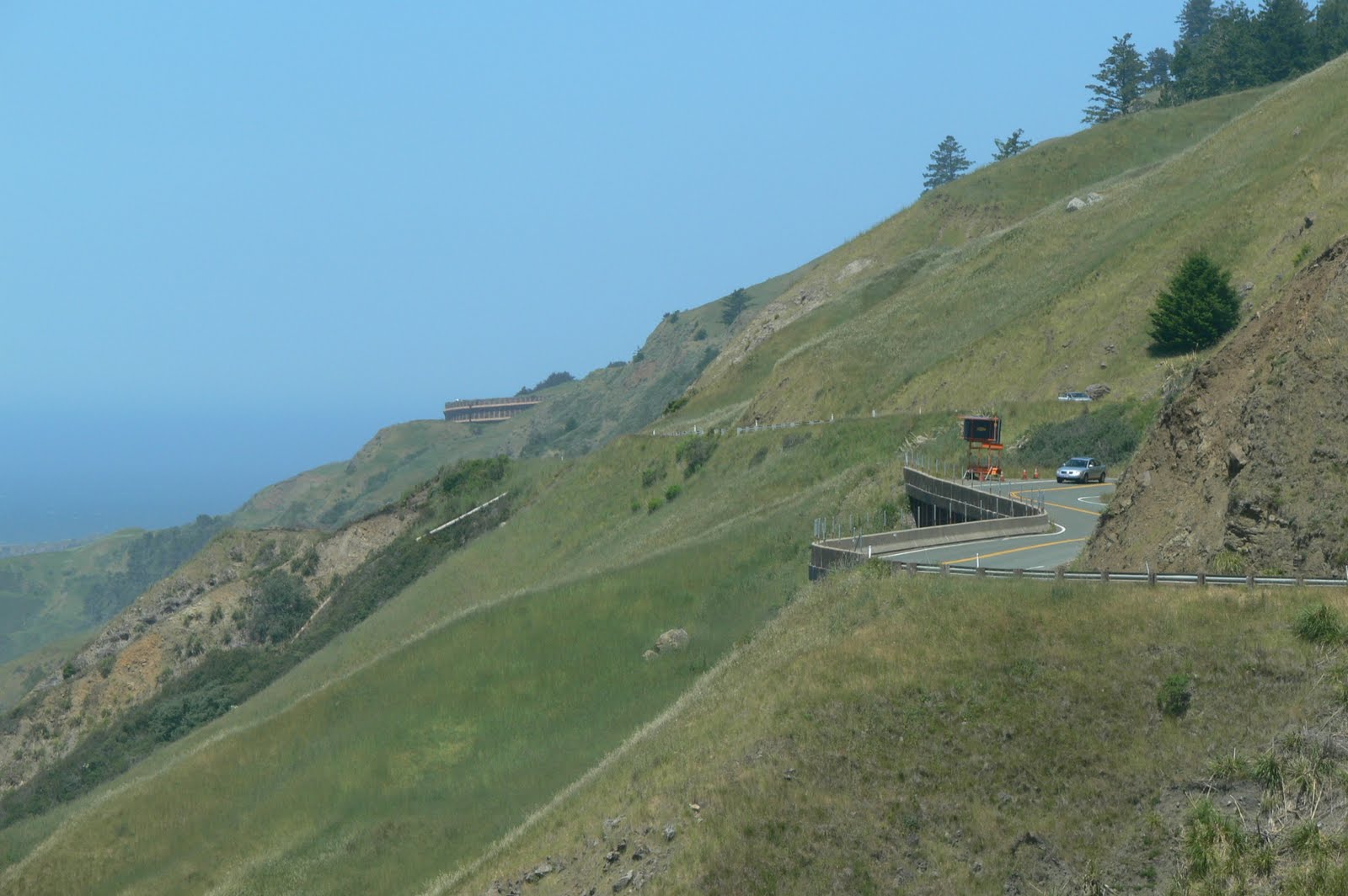
After returning to our Roadtrek, we decided to go for a drive up to where a rockslide had closed Highway 1 where we expected to drive thru to Monterey the next day. It was quite a ride on a windy cliff-hanging road. We didn't quite get to the slide as we thought we should be headed back for dinner before it got too dark. One interesting stop at the beginning of our drive was to look upon elephant seals laying about on the beach. Quite the spectacle.
That was it for the day....
Day 37 - Malibu, CA


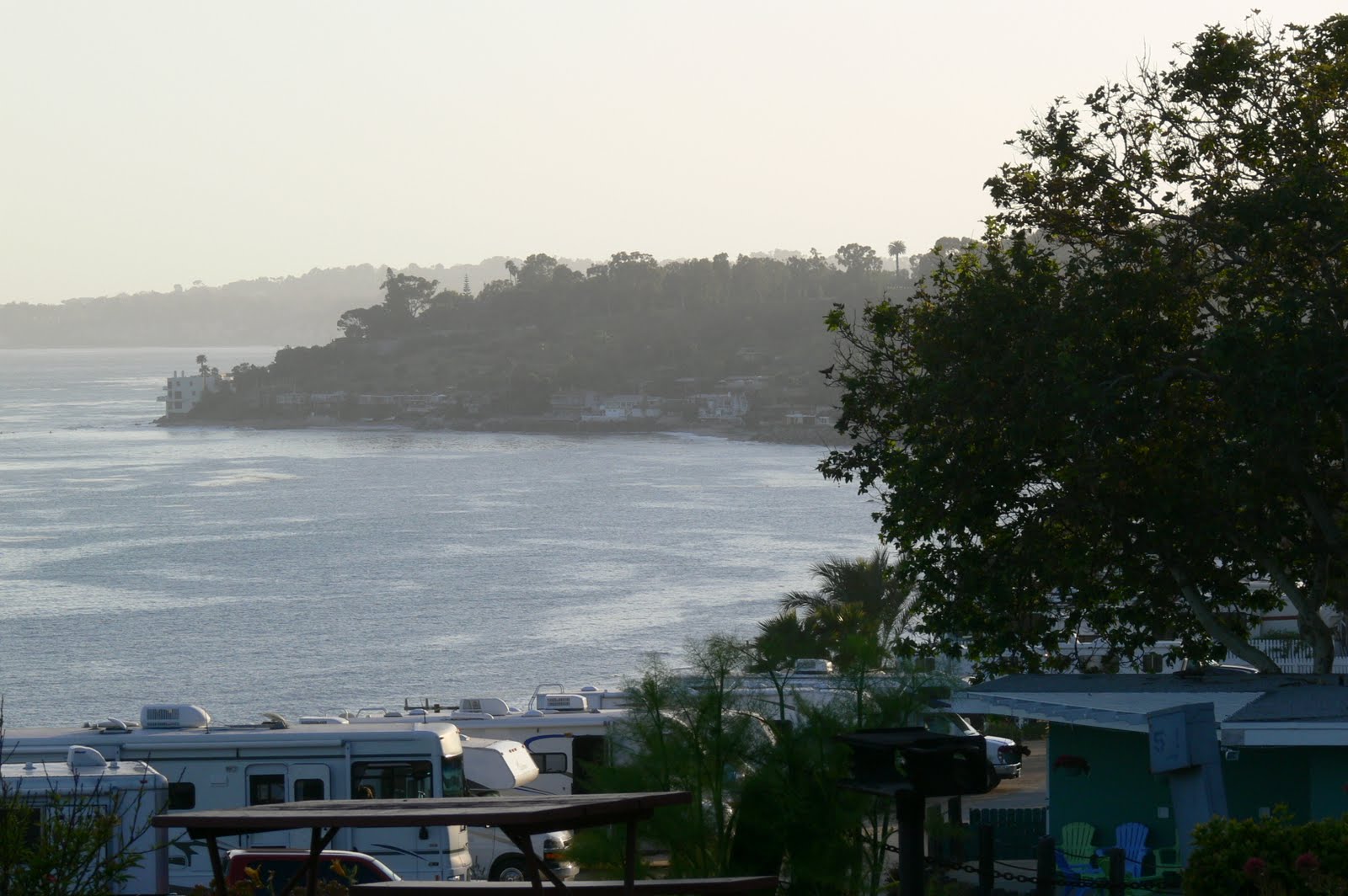
This is a great campground perched up on a cliff overlooking the sea. It was got quite chilly in the night but now I know how to start the furnace so all went well.
We had our toast and coffee on the picnic table looking out at the ocean. Pelicans flew by. Very nice.
We drove back the same route we took yesterday afternoon, following the Pacific Coast Highway, then Sunset Blvd., to reach the Getty Center. This time it was opened and very busy by the time we got there. A tram takes us from the underground parking up a relatively steep incline to the entrance at the top of the canyon looking down on the suburb of Bel Air. You will see from the photo how gorgeous the buildings are. They are a work of art by themselves. Designed by an architect named Richard Meier. It has been opened since 1997. Caught the architecture tour when we arrived which was most interesting and then we walked through the different exhibits in the different buildings. We took a guided tour for the Paris exhibition which was quite entertaining. We toured the gardens which blended beautifully with the architecture. A great visit.
Did some food shopping along Sunset Blvd. and got back to the campground for a quiet evening watching the sunset over the Pacific.
Subscribe to:
Posts (Atom)